Hasta › Auctions › São Paulo › Sorocaba › 1041/26 - Processo 0051446-70.2009.8.26.0602 - Lote 001 (ID 1584)
Land plot#1311510
1041/26 - Processo 0051446-70.2009.8.26.0602 - Lote 001 (ID 1584)

1041/26 - Processo 0051446-70.2009.8.26.0602 - Lote 001 (ID 1584)

📍 Éden, Sorocaba, SP, 18087-160
Opening bid (2nd round)
R$ 11,283,462
Appraised valueR$ 18,805,770
1st round (closed)R$ 18,805,770
View on the auctioneer's site and bid → (in Portuguese)🧮 Calculate the maximum bid← Back to auctions
This lot's description, auction notice and documents are in Portuguese, as published by the auctioneer. Bids are placed on the official auctioneer's website, in Portuguese.

Auction details

1st auction (closed)Oct 22, 2026
2nd auctionNov 11, 2026
Auction typeJudicial auction
AuctioneerANDRE CENCIN
OverviewCostsLocationDocumentsQuestionsSimilar

Hasta analysis

Typical price per m² in ÉdenR$ 5,233/m² · based on 5 listings
Listed on HastaSep 13, 2026 (45 d ago)

Description

Auctioneer's text, in Portuguese.

O terreno designado por Área A, da planta de desdobro elaborada por Construtora Sorocaba Ltda e Metal Land Empreendimentos Imobiliários Ltda, com a área de 54.097,40 metros quadrados, localizado no Bairro do Éden, deste município e comarca, situado na Estrada da Campininha, cuja descrição começa no ponto 21A, situado a 576,81 metros, do ponto 27, início da curva de confluência da Estrada da Campininha com a Avenida Victor Andrew; do ponto 21A segue em reta 252,13 metros, até o ponto 6, confrontando nessa face, com a Área B da mesma planta de desdobro; deflete à direita e segue em direção ao ponto 7 no rumo 23º 39’ 54” NW em uma distância de 57,21 metros, defletindo à direita, segue em direção ao ponto 8 no rumo 25º 01’ 13” NW em uma distância de 17,68 metros, defletindo à esquerda, segue em direção ao ponto 9 no rumo 27º 23’ 43” NW em uma distância de 82,27 metros, defletindo à direita, segue em direção ao ponto 10 no rumo 26º 39’ 00” NW em uma distância de 51,22 metros, defletindo à esquerda, segue em direção ao ponto 11 no rumo 36º 58’ 52” NW em uma distância de 14,32 metros, defletindo à direita, segue em direção ao ponto 12 no rumo 35º 27’ 17” NW em uma distância de 35,95 metros, confrontando do ponto 2 ao ponto 12 com propriedade de Oswaldo José Stecca, através de valo, defletindo à direita, segue em direção ao ponto 13 no rumo 62º 28’ 04” NE em uma distância de 41,34 metros, daí segue em curva à esquerda, em direção ao ponto 14 com desenvolvimento de curva 5,01 metros e com raio de 114,00 metros, daí segue em reta em direção ao ponto 15 no rumo 59º 56’ 52” NE em uma distância de 48,88 metros, daí segue em curva à esquerda, em direção ao ponto 16 com desenvolvimento de curva 24,36 metros e com raio de 64,00 metros, daí segue em reta, em direção ao ponto 17 no rumo 38º 08’ 53” NE, em uma distância de 50,84 metros, confrontando do ponto 12 ao ponto 17 com a Estrada das Olarias, daí segue em curva à direita, em direção ao ponto 18 com desenvolvimento de curva 14,18 metros e com raio de 9,00 metros, confrontando do ponto 17 ao ponto 18 com a confluência da Estrada das Olarias com a Estrada da Campininha através de linha de divisa, daí segue em reta, em direção ao ponto 19 no rumo 45º 44’ 00” SE em uma distância de 147,37 metros, defletindo à direita, segue em direção ao ponto 20 no rumo 45º 22’ 14” SE em uma distância de 56,76 metros, defletindo à direita, segue em direção ao ponto 21 no rumo 38º 16’ 29” SE em uma distância de 17,81 metros, defletindo à direita, segue em direção ao ponto 21A no rumo 36º 31’ 56” SE em uma distância de 29,48 metros, atingindo o ponto de origem desta descrição, perfazendo a área de 54.097,40 metros quadrados. Observação: Não há edificações no local. Toda a propriedade é devidamente fechada e cercada em suas divisas por mourões de madeira/concreto, com cerca de arame farpado, com acesso pela Rua Luiz Carlos Guerra (Estrada da Campininha), Estrada das Olarias e Rua Projetada (Nova Estrada da Campininha pelo Google Maps), respectivamente. CADASTRO MUNICIPAL Nº 57.64.08.0001.00.000. MATRÍCULA Nº 126.395 do 1º Oficial de Registro de Imóveis de Sorocaba/SP. LOCALIZAÇÃO: Estrada da Campininha, Bairro do Éden, Sorocaba/SP, nas proximidades da confluência com a Avenida Victor Andrew e com frente/confrontação parcial para a Estrada das Olarias.

Location

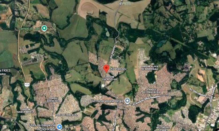
📍 Éden, Sorocaba, SP

View larger map ↗

Region profile

  • Average monthly wage (formal employment): 3 salários mínimos (reference year: 2021)
  • Population (2022 Census): 723,682 pessoas (reference year: 2022)
  • Population density: 1,609 hab/km² (reference year: 2022)
  • Population earning up to ½ minimum wage: 31.7 % (reference year: 2010)
  • Employed population: 38.13 % (reference year: 2022)
  • Area of the municipality: 449.872 km² (reference year: 2025)
  • Annual growth rate: 1.76 % a.a. (reference year: 2022)
  • Literacy rate (15+): 97.92 % (reference year: 2022)

What it costs to win this property

Opening bidR$ 18,805,770
Auctioneer's commission (5%)R$ 940,289
ITBI transfer tax (3%)R$ 564,173
Deed and registration (1.5%)R$ 282,087
Estimated total costR$ 20,592,319

Standard market percentages; the auction notice (edital) may set different amounts (especially the commission) and ITBI varies by municipality — confirm in the notice and with the city hall. Amounts in Brazilian reais. Unpaid property tax (IPTU) and condo fees, and the cost of evicting occupants, are not included: who pays them depends on the type of auction — see "What to check before bidding".

There are 566 auction properties on sale right now in Sorocaba/SP, with an average discount of 40% on the appraisal.

Court case details

Case number0051446-70.2009.8.26.0602
Court1ª VARA CÍVEL DA COMARCA DE SOROCABA - SP 1041/26 - Processo 0051446-70

Frequently asked questions

How does buying this land plot at auction work?

The property goes to whoever places the highest bid, subject to the minimum bid in the auction notice. Always read the notice (edital) and the property title (matrícula) before bidding: they set out the rules, deadlines, debts that come with the property and its occupancy status.

What is the minimum bid for this land plot?

The minimum bid is R$ 11,283,462. It is the lowest amount accepted to win; the final price may rise as bids come in.

When is the auction for this land plot?

1st auction on Oct 22, 2026, 2nd auction on Nov 11, 2026. Always confirm the dates in the official notice, as they may be postponed or suspended.

What costs are there besides the bid itself?

Besides the bid, the winner usually pays the auctioneer's commission (generally 5%), ITBI transfer tax, registration fees and, depending on the notice, overdue IPTU and condo fees and the cost of eviction. Add everything up before setting your maximum bid.

Can the property be occupied?

Yes. An auction property may be occupied by the former owner, a tenant or third parties. Who occupies it changes the time and cost of getting it vacated — check the occupancy status in the notice before bidding.

🤖 AI analysis — Veredika
The AI reads the listing, the auction notice and the property title, checks them against Brazilian law and returns ranked risks, a cost spreadsheet and a verdict — so you cut the risk before you bid. The report is written in Portuguese.
Checking documents…

What to check before bidding — Judicial auction

  • Confirm in the auction notice which debts stay with the winning bidder and which are settled from the price.
  • Check whether the property is occupied and who is responsible for getting it vacated.
  • Read the current property title (matrícula): attachments, mortgages and annotations change the real cost.
  • Check the deadlines and dates of each auction round, and the minimum bid of each.

The auction type above comes from the auctioneer's catalog and must be confirmed in the notice. The full analysis — procedure classification, encumbrances, total cost and title risks — is done in the Veredika report (in Portuguese).

Auctioneer in charge

ANDRE CENCIN