Description
Auctioneer's text, in Portuguese.
Endereço:
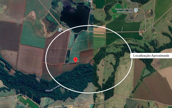
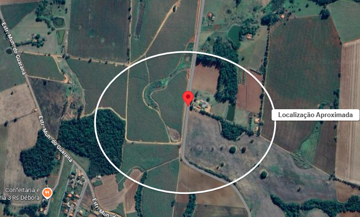
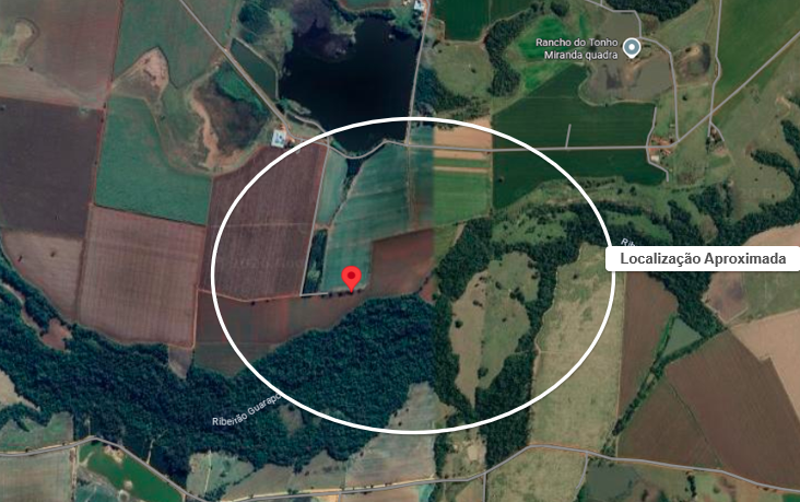
ESTRADA MUNICIPAL JOAQUIM RODRIGUES, -, GUARAPÓ
Cidade:
QUADRA
Estado:
SP
Processo:
0004201-11.2020.8.26.0624
Leiloeiro:
EDUARDO JORDÃO BOYADJIAN - JUCESP Nº 464
GRANDE OPORTUNIDADE: FRAÇÕES IDEAIS DA FAZENDA SÃO JOSÉ, EM QUADRA/SP.
DESCRIÇÃO CONFORME MATRÍCULA: FRAÇÃO IDEAL DE 12,50% DA FAZENDA SÃO JOSÉ (GLEBA A), ESTRADA MUNICIPAL JOAQUIM RODRIGUES, BAIRRO GUARAPÓ, MUNICÍPIO DE QUADRA/SP.
Marco inicial: vértice SPSC-M-0235 (coordenadas long. -48º02’55,355” e lat. -23º19’13,146”), situado em ponto comum da referida estrada; do imóvel da matrícula nº 39.099, e do imóvel em questão. Vértices (código, longitude, latitude e altitude); seguimento (código, azimute e distância), respectivos: Código SPSC-M-0235, Longitude -48º02’55,355”, Latitude -23º19’13,146”, Altitude 650,23m; Código SPSC-P-1784, Azimute 112º13’, Dist. 358,46m; Código SPSC-P-1784, Longitude -48º02’43,676”, Latitude -23º19’17,552”, Altitude 654,14m; Código AXW-M-347, Azimute 119º22’, Dist. 404,48m; Código AXW-M-347, Longitude -48º02’31,271”, Latitude -23º19’24,001”, Altitude 662,63m; Código SPSC-P-1783, Azimute 171º38’, Dist. 399,16m; Código SPSC-P-1783, Longitude -48º02’29,229”, Latitude -23º19’36,837”, Altitude 653,87m; Código SPSC-M-0234, Azimute 292º54’, Dist. 490,51m; Código SPSC-M-0234, Longitude-48º02’45,132”, Latitude -23º19’30,633”, Altitude 648,55m; Código SPSC-V-0632, Azimute 12º20’, Dist. 10,77m; SPSC-V-0633, Longitude -48º02’45,051”, Latitude -23º19’30,291”, Altitude 648,32m; Código SPSC-V-0633, Azimute 03º52’, Dist. 7,15m; Código SPSC-V-0633, Longitude -48º02’45,034”, Latitude -23º19’30,059”, Altitude 648,47m; Código SPSC-V-0634, Azimute 02º11’, Dist. 5,94m; Código SPSC-V-0634, Longitude -48º02’45,026”, Latitude -23º19’29,866”, Altitude 648,54m; Código SPSC-V-0635, Azimute 01º02’, Dist. 7,85m; Código SPSC-V-0635, Longitude -48º02’45,021”, Latitude -23º19’29,611”, Altitude 648,65m; Código SPSC-V-0636, Azimute 352º36’, Dist. 8,84m; Código SPSC-V-0636, Longitude -48º02’45,061”, Latitude -23º19’29,326”, Altitude 648,78m; Código SPSC-V-0637, Azimute 347º16’, Dist. 8,9m; Código SPSC-V-0637, Longitude -48º02’45,130”, Latitude -23º19’29,044”, Altitude 648,85m; Código SPSC-V-0638, Azimute 339º48’, Dist. 7,57m; Código SPSC-V-0638, Longitude -48º02’45,222”, Latitude -23º19’28,813”, Altitude 648,93m; Código SPSC-V-0639, Azimute 334º51’, Dist. 8,16m; Código SPSC-V-0639, Longitude -48º02’45,344”, Latitude -23º19’28,573”, Altitude 649,01m; Código SPSC-V-0640, Azimute 330º43’, Dist. 29,52m; Código SPSC-V-0640, Longitude -48º02’45,852”, Latitude -23º19’27,736”, Altitude 649,28m; Código SPSC-V-0641, Azimute 329º40’, Dist. 37,25m; Código SPSC-V-0641, Longitude -48º02’46,514”, Latitude -23º19’26,691”, Altitude 650,20m; Código SPSC-V-0642, Azimute 329º11’, Dist. 47,50m; Código SPSC-V-0642, Longitude -48º02’47,370”, Latitude -23º19’25,365”, Altitude 651,43m; Código SPSC-V-0643, Azimute 328º01’, Dist. 6,38m; Código SPSC-V-0643, Longitude -48º02’47,489”, Latitude -23º19’25,189”, Altitude 651,64; Código SPSC-V-0644, Azimute 323º04’, Dist. 7,24m; Código SPSC-V-0644, Longitude -48º02’47,642”, Latitude -23º19’25,001”, Altitude 651,88m; Código SPSC-V-0645, Azimute 317º35’, Dist. 7,79m; Código SPSC-V-0645, Longitude -48º02’47,827”, Latitude -23º19’24,814”, Altitude 652,06m; Código SPSC-V-0646, Azimute 309º56’, Dist. 8,67m; Código SPSC-V-0646, Longitude -48º02’48,061”, Latitude -23º19’24,633”, Altitude 652,21m; Código SPSC-V-0647, Azimute 308º21’, Dist. 7,54m; Código SPSC-V-0647, Longitude -48º02’48,269”, Latitude -23º19’24,481”, Altitude 652,31m; Código SPSC-V-0648, Azimute 295º56’, Dist. 8,09m; Código SPSC-V-0648, Longitude -48º02’48,525”, Latitude -23º19’24,366”, Altitude 652,34m; Código SPSC-V-0649, Azimute 298º25’, Dist. 7,17m; Código SPSC-V-0649, Longitude -48º02’48,747”, Latitude -23º19’24,255”, Altitude 652,38m; Código SPSC-V-0650, Azimute 292º40’, Dist. 139,62m; Código SPSC-V-0650, Longitude -48º02’53,281”, Latitude -23º19’22,505”, Altitude 650,79m; Código SPSC-V-0651, Azimute 293º31’, Dist. 3,16m; Código SPSC-V-0651, Longitude -48º02’53,383”, Latitude -23º19’22,464”, Altitude 650,73m; Código SPSC-V-0652, Azimute 296º07’, Dist. 21,11m; Código SPSC-V-0652, Longitude -48º02’54,050”, Latitude -23º19’22,162”, Altitude 650,44m; Código SPSC-V-0653, Azimute 297º25’, Dist. 14,69m; Código SPSC-V-0653, Longitude -48º02’54,509”, Latitude -23º19’21,942”, Altitude 650,20m; Código SPSC-V-0654, Azimute 300º01’, Dist. 15,56m; Código SPSC-V-0654, Longitude -48º02’54,983”, Latitude -23º19’21,689”, Altitude 650,00m; Código SPSC-V-0655, Azimute 304º01’, Dist. 10,56m; Código SPSC-V-0655, Longitude -48º02’55,291”, Latitude -23º19’21,497”, Altitude 649,92m; Código SPSC-V-0656, Azimute 305º33’, Dist. 6,88m; Código SPSC-V-0656, Longitude -48º02’55,488”, Latitude -23º19’21,367”, Altitude 649,92m; Código SPSC-V-0657, Azimute 310º24’, Dist. 5,41m; Código SPSC-V-0657, Longitude -48º02’55,633”, Latitude -23º19’21,253”, Altitude 649,96m; Código SPSC-V-0658, Azimute 313º12’, Dist. 4,72m; Código SPSC-V-0658, Longitude -48º02’55,754”, Latitude -23º19’21,148”, Altitude 649,98m; Código SPSC-V-0659, Azimute 317º16’, Dist. 3,89m; Código SPSC-V-0659, Longitude -48º02’55,847”, Latitude -23º19’21,055”, Altitude 649,95m; Código SPSC-V-0660, Azimute 322º49’, Dist. 3,67m; Código SPSC-V-0660, Longitude -48º02’55,925”, Latitude -23º19’20,960”, Altitude 649,95m; Código SPSC-V-0661, Azimute 327º54’, Dist. 3,85m; Código SPSC-V-0661, Longitude -48º02’55,997”, Latitude -23º19’20,854”, Altitude 649,95m; Código SPSC-V-0662, Azimute 332º20’, Dist. 2,57m; Código SPSC-V-0662, Longitude -48º02’56,039”, Latitude -23º19’20,780”, Altitude 649,94m; Código SPSC-V-0663, Azimute 339º50’, Dist. 2,88m; Código SPSC-V-0663, Longitude -48º02’56,074”, Latitude -23º19’20,692”, Altitude 649,95m; SPSC-V-0664, Azimute 341º40’, Dist. 3,44m; Código SPSC-V-0664, Longitude -48º02’56,112”, Latitude -23º19’20,586”, Altitude 649,98m; Código SPSC-V-0665, Azimute 345º57’, Dist. 3,04m; Código SPSC-0665, Longitude -48º02’56,138”, Latitude -23º19’20,490”, Altitude 650,04; Código SPSC-V-0666, Azimute 351º32’, Dist. 3,67m; Código SPSC-V-0666, Longitude -48º02’56,157”, Latitude 23º19’20,372”, Altitude 650,05m; Código SPSC-V-0667, Azimute 357º30’, Dist. 3,94m; Código SPSC-V-0667, Longitude -48º02’56,163”, Latitude -23º19’20,244”, Altitude 650,06m; Código SPSC-V-0668, Azimute 01º03’, Dist. 7,75m; Código SPSC-V-0668, Longitude -48º02’56,158”, Latitude -23º19’19,992”, Altitude 650,05m; Código SPSC-V-0669, Azimute 04º21’, Dist. 7,87m; Código SPSC-V-0669, Longitude -48º02’56,137”, Latitude -23º19’19,737”, Altitude 650,02m; Código SPSC-M-0235, Azimute 06º15’, Dist. 204,00m. Confrontantes: SPSC-M-0235/SPSC-P-1784, imóvel da matrícula nº 39.099; SPSC-P-1784/AXW-M-347, imóvel da matrícula nº 105.918; AXW-M-347/SPSC-P-1783, imóvel da matrícula nº 105.919; SPSC-P-1783/SPSC-M-0234, imóvel da matrícula nº 82.860; SPSC-M-0234/SPSC-M-0235, estrada Municipal Joaquim Rodrigues. Área: 25,1143 hectares; perímetro de 2.357,22m. Cadastro no INCRA nº 631.078.003.492-1; área total 494,8983 hectares; módulo rural 24,4016 hectares; nº módulos rurais 19,22; módulo fiscal 18,00 hectares; nº módulos fiscais 27,4944; fração mínima de parcelamento 2,00 hectares.
MATRÍCULA:
105.917 do 1º Cartório de Registro de Imóveis de Tatuí/SP.
ÔNUS:
A PENHORA do bem encontra-se às fls. 156-157 dos autos, bem como na
AV. 6
da matrícula. Consta, na
AV. 5, PENHORA
derivada dos autos nº 40000-94.2013.8.26.0624, da 1ª Vara Cível do Foro da Comarca de Tatuí/SP.
CONTRIBUINTE: INCRA Nº
631.078.003.492-1; SICAR/CAR nº 35416530022489.
DÉBITOS FISCAIS:
Não foi possível apurar a existência de débitos fiscais, sendo ônus do arrematante a verificação perante os órgãos competentes.
Nos leilões judiciais, de qualquer natureza, o procedimento pós arrematação deverá ser conduzido pela assessoria jurídica do arrematante. Ressalta-se que o Leiloeiro, como auxiliar da Justiça, está impedido de prestar assessoria direta aos arrematantes, uma vez que exerce função pública por delegação e deve manter-se imparcial e transparente em relação a todos os participantes, a fim de preservar a integridade da Hasta Pública, em conformidade com o disposto no Decreto nº 21.981/32 e nos artigos 884 e seguintes do Código de Processo Civil. Contudo, a equipe do leiloeiro permanecerá à disposição para esclarecer eventuais dúvidas e fornecer informações gerais ao arrematante, sempre dentro dos limites do exercício da função de leiloeiro.
Compre Já
Deseja comprar o Lote Fração Ideal de 12,5% – Fazenda São José (Gleba A) - (02) no valor de R$
?
Confirmar
Cancelar
Oferta Automatica
A oferta Automática é maior que Compre Já, deseja continuar?
Confirmar
Cancelar
Atenção: para o funcionamento do site é necessario habilitar JavaScript.
Se não for possivel alterar esta configuração, por favor, utilize outro navegador ou equipamento.
Copyright © 2020 VIP Leilões
CNPJ n.º 24.766.265/0001-63
Praça dos Omáguas, 98, Pinheiros, São Paulo/SP
Brasil, CEP 05419-020 - Empresa do grupo VIP.
Navegue Pelo Site
Quem Somos
Agenda
Como Comprar
Serviços
Quero Vender
Nos Indique
Blog
Ouvidoria
Fale Conosco
Política de Privacidade
DPO - Encarregado de Dados Pessoais (LGPD)
Para qualquer assunto relacionado aos seus dados pessoais, por favor, contate nosso DPO, através do email:
[email protected]
Trabalhe Conosco
Nossa Newsletter
Receba atualizações, novidades e ofertas exclusivas.
O pareceiro que anuncia nesta página é o único responsável pelas transações comerciais que realizar com usuários do web site VIP Leilões. A comercialização do produto anunciado, bem como a garantia de sua legítima procedência, é de inteira responsabilidade do anunciante. As informações veiculadas nos anúncios deste site são de inteira responsabilidade do anunciante, não podendo o usuário responsabilizar a VIP Leilões pela veracidade e/ou autenticidade das mesmas. A VIP Leilões não é responsável por quaisquer danos diretos e/ou indiretos causados a terceiros, advindos da exibição dos anúncios em desacordo com o Código de Defesa do Consumidor e outras lesgilações aplicáveis ao comércio e/ou prestação de serviços por parte do anunciante. As vendas e entregas aos usuários e/ou terceiros de produtos anunciados no site são de inteira responsabilidade do anunciante. O usuário reconhece como sendo de sua exclusiva responsabilidade os riscos assumidos nas negociações que vier a efetuar com outros usuários do site. Para oferecer uma melhor experiência de navegação, a VIP Leilões utiliza cookies. Ao navegar pelo site você concorda com o uso dos mesmos.
v1.7.664.204
Topo

 Rural property
 Rural property
 Rural property
 Apartment
 Apartment
 Apartment
 Apartment
 House
 House
 Apartment
 Apartment