Hasta › Auctions › Mato Grosso › Alta Floresta › IMÓVEL RURAL DENOMINADO “FAZENDA SOLEDADE”, situado no Município de Nortelândia, Estado de Mato Grosso, objeto da Matrícula nº 3.345 do Cartório de...
Rural property#2540936
IMÓVEL RURAL DENOMINADO “FAZENDA SOLEDADE”, situado no Município de Nortelândia, Estado de Mato Grosso, objeto da Matrícula nº 3.345 do Cartório de...

IMÓVEL RURAL DENOMINADO “FAZENDA SOLEDADE”, situado no Município de Nortelândia, Estado de Mato Grosso, objeto da Matrícula nº 3.345 do Cartório de...

📍 Alta Floresta, MT
This lot's description, auction notice and documents are in Portuguese, as published by the auctioneer. Bids are placed on the official auctioneer's website, in Portuguese.

Auction details

1st auctionNov 16, 2026
Auction typeExtrajudicial auction
AuctioneerSilvio Luiz Silva de Moura Leite
OverviewCostsLocationDocumentsQuestionsSimilar

Hasta analysis

Listed on HastaNov 07, 2026 (6 d ago)

Description

Auctioneer's text, in Portuguese.

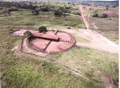
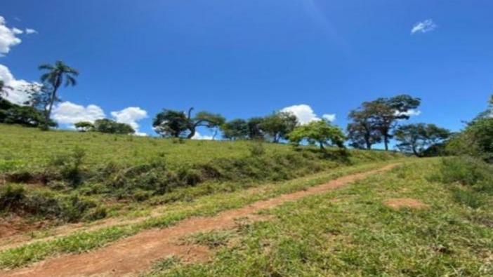
Edital ABERTO Lote 01 IMÓVEIS RURAIS FAZENDAS - Descrição do bem: IMÓVEL RURAL DENOMINADO “FAZENDA SOLEDADE”, situado no Município de Nortelândia, Estado de Mato Grosso, objeto da Matrícula nº 3.345 do Cartório de Registro de Imóveis da Comarca de Nortelândia/MT.Conforme consta da descrição registral, o imóvel, em razão de RETIFICAÇÃO DE ÁREA (ALTERAÇÃO DE MEDIDAS ANGULARES E LINEARES E ATUALIZAÇÃO DESCRITIVA DO IMÓVEL), teve sua área retificada e georreferenciada, passando a possuir 1.251,9499 hectares (um mil duzentos e cinquenta e um hectares, noventa e quatro ares e noventa e nove centiares), com perímetro de 22.035,22 metros, conforme planta e memorial descritivo constantes do registro imobiliário. A descrição do imóvel inicia-se no vértice AVP-P-0291, de coordenadas Longitude -56°53'28,032", Latitude -14°08'54,303" e Altitude 501,53 m, seguindo confrontando com a RODOVIA BR-364, no azimute 90°48', pela distância de 520,78 metros, até o vértice FHA-M-0348, de coordenadas Longitude -56°53'10,670", Latitude - 14°08'54,643" e Altitude 487,91 m. Deste, segue confrontando com CNS 06.347-9 – Matrícula desmembrada da Matrícula nº 2.992 – FAZENDA GL-II, no azimute 167°46', pela distância de 3.186,29 metros, até o vértice FHA-M-0345, de coordenadas Longitude -56°52'48,173", Latitude -14°10'35,859" e Altitude 498,20 m. Deste, segue confrontando com CNS 06.347-9 – Matrícula 342-A – FAZENDA CAMARGO, no azimute 240°55', pela distância de 2.207,77 metros, até o vértice AVF-M-0006, de coordenadas Longitude -56°53'32,520", Latitude -14°11'10,769" e Altitude 501,24 m. Deste, segue no azimute 154°11', pela distância de 1.092,23 metros, até o vértice AVP-V-3050, de coordenadas Longitude -56°53'36,660", Latitude -14°11'42,750" e Altitude 502,37 m. Deste, segue no azimute 154°22', pela distância de 2.059,27 metros, até o vértice AVFM- 0005, de coordenadas Longitude -56°53'06,960", Latitude -14°12'43,160" e Altitude 389,20 m. Deste, segue confrontando com CNS 06.349-5 – Matrícula 5.357 – FAZENDA OLÍMPIA, no azimute 253°21', pela distância de 1.758,62 metros, até o vértice FHA-M-1158, de coordenadas Longitude -56°54'03,157",Latitude -14°12'59,545" e Altitude 381,84 Deste, segue confrontando com CNS 06.347-9 – Matrícula desmembrada da Matrícula nº 2.992 – FAZENDA DOIS IRMÃOS, no azimute 343°20', pela distância de 4.836,41 metros, até o vértice FHA-M-0084, de coordenadas Longitude -56°54'49,372", Latitude - 14°10'28,788" e Altitude 450,34 m. Deste, segue confrontando com CNS 06.347-9 – Matrícula desmembrada da Matrícula nº 2.992 – FAZENDA MARGARETH “3”, no azimute 99°22', pela distância de 2.121,63 metros, até o vértice FHA-M-0346, de coordenadas Longitude -56°53'39,568", Latitude -14°10'40,024" e Altitude 519,97 m. Deste, segue no azimute 347°33', pela distância de 3.207,59 metros, até o vértice FHA-M-0349, de coordenadas Longitude -56°54'02,614", Latitude -14°08'58,116" e Altitude 482,41 m. Deste, segue confrontando com a RODOVIA BR-364, no azimute 83°33', pela distância de 1.043,79 metros, até o vértice AVP-P-0291, de coordenadas Longitude -56°53'28,032", Latitude -14°08'54,303" e Altitude 501,53 m, ponto inicial desta descrição. As coordenadas encontram-se referenciadas ao Sistema Geodésico Brasileiro – SIRGAS2000, conforme descrição constante da matrícula, sendo o imóvel objeto de georreferenciamento e certificação perante o INCRA. A descrição acima corresponde à descrição constante da matrícula nº 3.345 juntada aos autos, prevalecendo a descrição e caracterização registral do imóvel para fins de identificação jurídica do bem objeto da alienação judicial. Segundo a vistoria realizada pelo Oficial de Justiça Avaliador, o imóvel possui terra roxa, encontrando-se parte da área utilizada para cultivo de milho, abrangendo aproximadamente 617 hectares, sendo 300 hectares cultivados por Ricardo Polo Rotilh e 317 hectares pelos irmãos Márcio Guarda Lara e Luciano Guarda Lara, estando o restante da área aberta e mecanizada. O imóvel é atualmente explorado mediante atividade agrícola e, segundo a avaliação, não possui edificações. Ver arquivos do lote Favorito Avaliação: R$ 67.804.200,00 Lance Mínimo: R$ 33,90 Incremento: R$ 700.000,00

Location

📍 Alta Floresta, MT
Approximate location — the listing did not give the exact address.

View larger map ↗

Region profile

  • Average monthly wage (formal employment): 2.2 salários mínimos (reference year: 2021)
  • Population (2022 Census): 58,613 pessoas (reference year: 2022)
  • Population density: 6.54 hab/km² (reference year: 2022)
  • Population earning up to ½ minimum wage: 33.3 % (reference year: 2010)
  • Employed population: 27.61 % (reference year: 2022)
  • Area of the municipality: 8,955 km² (reference year: 2025)
  • Annual growth rate: 1.48 % a.a. (reference year: 2022)
  • Literacy rate (15+): 94.2 % (reference year: 2022)

What it costs to win this property

Opening bidR$ 67,804,200
Auctioneer's commission (5%)R$ 3,390,210
ITBI transfer tax (3%)R$ 2,034,126
Deed and registration (1.5%)R$ 1,017,063
Estimated total costR$ 74,245,599

Standard market percentages; the auction notice (edital) may set different amounts (especially the commission) and ITBI varies by municipality — confirm in the notice and with the city hall. Amounts in Brazilian reais. Unpaid property tax (IPTU) and condo fees, and the cost of evicting occupants, are not included: who pays them depends on the type of auction — see "What to check before bidding".

There are 9 auction properties on sale right now in Alta Floresta/MT.

Documents (1)

Official documents, in Portuguese.

Frequently asked questions

How does buying this rural property at auction work?

The property goes to whoever places the highest bid, subject to the minimum bid in the auction notice. Always read the notice (edital) and the property title (matrícula) before bidding: they set out the rules, deadlines, debts that come with the property and its occupancy status.

What is the minimum bid for this rural property?

The minimum bid is R$ 67,804,200. It is the lowest amount accepted to win; the final price may rise as bids come in.

When is the auction for this rural property?

1st auction on Nov 16, 2026. Always confirm the dates in the official notice, as they may be postponed or suspended.

What costs are there besides the bid itself?

Besides the bid, the winner usually pays the auctioneer's commission (generally 5%), ITBI transfer tax, registration fees and, depending on the notice, overdue IPTU and condo fees and the cost of eviction. Add everything up before setting your maximum bid.

Can the property be occupied?

Yes. An auction property may be occupied by the former owner, a tenant or third parties. Who occupies it changes the time and cost of getting it vacated — check the occupancy status in the notice before bidding.

🤖 AI analysis — Veredika
The AI reads the listing, the auction notice and the property title, checks them against Brazilian law and returns ranked risks, a cost spreadsheet and a verdict — so you cut the risk before you bid. The report is written in Portuguese.
Checking documents…

What to check before bidding — Extrajudicial auction

  • Confirm that the consolidation of ownership is recorded in the property title (matrícula).
  • Check which condo-fee and IPTU debts follow the property after the sale.
  • Confirm the deadline and conditions of the former debtor's right of first refusal.
  • Check whether eviction is at the winning bidder's expense and within what period.

⚠ We did not find the property title (matrícula) in the original listing — ask the auctioneer before bidding.

The auction type above comes from the auctioneer's catalog and must be confirmed in the notice. The full analysis — procedure classification, encumbrances, total cost and title risks — is done in the Veredika report (in Portuguese).