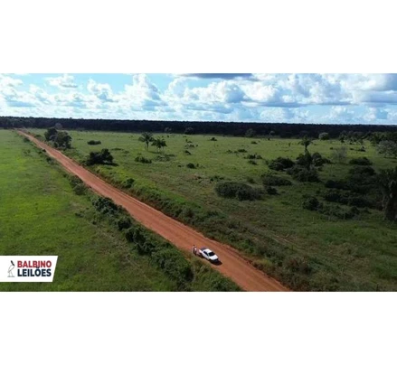
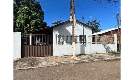
Hasta › Auctions › Mato Grosso › Juara › Fazenda Santa Amália com área de 2.481,6665ha em Juara-MT.
Rural property#2241641
Fazenda Santa Amália com área de 2.481,6665ha em Juara-MT.

Fazenda Santa Amália com área de 2.481,6665ha em Juara-MT.

📍 Juara-MT, Juara, MT
Opening bid (2nd round)
R$ 6,700,500
Appraised valueR$ 11,167,499
1st round (closed)R$ 11,167,499
View on the auctioneer's site and bid → (in Portuguese)🧮 Calculate the maximum bid← Back to auctions
This lot's description, auction notice and documents are in Portuguese, as published by the auctioneer. Bids are placed on the official auctioneer's website, in Portuguese.

Auction details

1st auction (closed)Oct 22, 2026
2nd auctionOct 29, 2026
Auction typeJudicial auction
AuctioneerKRONBERG ALIENACOES, REMOCOES E GUARDA S/A
OverviewCostsLocationDocumentsQuestionsSimilar

Hasta analysis

Listed on HastaOct 23, 2026 (6 d ago)

Description

Auctioneer's text, in Portuguese.

Fazenda Santa Amália com área de 2.481,6665ha em Juara-MT. Imóvel denominado Fazenda Santa Amália que conta com área total medida e demarcada de 2.481,6665ha e perímetro de 23.07289m, além das respectivas especificações e características contidas na matrícula que consta nos autos do processo. Matrícula nº 10.155 do 1º Serviço de Registro de Imóveis e de Títulos e Documentos da Comarca de Juara-MT: Imóvel - denominado Fazenda Santa Amália, que conta com área total medida e demarcada de 2.481,6665ha e perímetro de 23.072,89m, sendo que seu caminhamento passa a ser descrito como se segue, tendo início no vértice ALY-M-0921, de coordenadas N 8.824.607,116m e E 493.887,175m, situado no limite direito da faixa de domínio da estrada municipal, sentido Fazenda do Sr. Elias-Alta Floresta com a Fazenda Santa Maria; deste, segue confrontando com a Fazenda Santa Maria de Juraci Gomes Ribeiro, Leonidas Roque Volpato e Espólio de Andréa Lucio Volpato, código INCRA: 901.199.116.491-4, matrícula nº.: 5.797 do CRI de Juara, com os seguintes azimutes e distâncias: 174°01'06" e 4.545,24 m até o vértice ALY-M-0922, de coordenadas N 8.820.086,626m e E 494.360,835m; 173°25'37" e 3.705,47 m até o vértice ALY-M-0923, de coordenadas N 8.816.405,516m e E 494.786,006m, situado no limite da Fazenda Santa Maria com a Fazenda Volpato; deste, segue confrontando com a Fazenda Volpato de Leonidas Roque Volpato e Nair Volpato Ribeiro, código INCRA: 950.033.534.234-3, matrícula nº.: 979 do CRI de Juara, com azimute de 262°57'37" e distância: de 3.286,48 m até o vértice ALY-M-0935, de coordenadas N 8.816.002,739m e E 491.523,301m, situado no limite da Fazenda Volpato com a Fazenda Santa Luiza; deste, segue confrontando com a Fazenda Santa Luiza de Elizabeth Volpato Vieira, código INCRA: 950.033.535.796-0, matrícula nº.: 982 do CRI de Juara, com azimute de 354°12'17" e distância de 4.276,42 m até o vértice ALY-M-0715, de coordenadas N 8.820.257,306m e E 491.091,482m, situado no limite da Fazenda Santa Luiza com a Fazenda Dois Irmãos; deste, segue confrontando com a Fazenda Dois Irmãos de Nestor Moisés Volpato e Alcides Antonio Volpato, código INCRA: 901.199.004.936-4, matrícula nº.: 980 do CRI de Juara, com os seguintes azimutes e distâncias: 85°41'37" e 492,21 m até o vértice ALY-M-0936, de coordenadas N 8.820.294,265m e E 491.582,298m; 354°53'22" e 4.087,17 m até o vértice ALY-M-0937, de coordenadas N 8.824.365,187m e E 491.218,216m, situado no limite da Fazenda Dois Irmãos com o limite direito da faixa de domínio da estrada municipal, sentido Fazenda do Sr. Elias-Alta Floresta; deste, segue confrontando com o limite direito da faixa de domínio da referida estrada, com azimute de 84°49'14" e distância de 2.679,90 m até o vértice ALY-M-0921, ponto inicial da descrição deste perímetro. Todas as coordenadas do imóvel, aqui descritas, e das bases de controle implantadas e denominadas de: BASE-SANTA BARBARA, situada na Fazenda Curitiba III, vizinha da Fazenda Santa Barbara, de coordenadas: UTM N 8.823.686,921m e E 487.884,150m e geográfica Lat. 10°38'28,3086"S e Long. 57°06'38,7871"W, ajustadas a partir das estações ativas da Rede Brasileira de Monitoramento Contínuo (RBMC): Estação Cuiabá (CUIB), código nº 92.583, de coordenadas: UTM N 8.280.082,107m e E 599.791,609m, MC: -57°, fuso 21, e geográficas Lat. 15°33'17,4029"S e Long. 56°04'09,7174"W, localizada em Cuiabá-MT; e Estação Bom Jesus da Lapa (BOMJ), código nº 93.030, de coordenadas: UTM N 8.534.106,082m e E 671.036,256m, MC: -45°, fuso 23, e geográficas Lat. 13°15'18,4236"S e Long. 43°25'16,8024"W, localizada em Bom Jesus da Lapa-BA; e BASE-SELVA II, situada no interior da Fazenda Selva II, de coordenadas: UTM N 8.822.594,974m e E 497.979,581m e geográficas Lat. 10°39'03,9298"S e Long. 57°01'06,5033"W, ajustadas a partir das estações ativas da Rede Brasileira de Monitoramento Contínuo (RBMC): Estação Brasília (BRAZ), código nº 91.200, de coordenadas: UTM N 8.234.791,575m e E 191.946,760m, MC: -45°, fuso 23, e geográficas Lat. 15°56'49,2964"S e Long. 47°52'38,7376"W, localizada em Brasília-DF, e Estação Cuiabá (CUIB), código nº 92.583, de coordenadas: UTM N 8.280.082,107m e E 599.791,609m, MC: -57°, fuso 21, e geográficas Lat. 15°33'17,4029"S e Long. 56°04'09,7174"W, localizada em Cuiabá-MT; estão georreferenciadas ao Sistema Geodésico Brasileiro, referenciadas ao meridiano central 57° WGr. e ao equador, fuso 21. Encontram-se representadas no Sistema UTM, tendo como datum o SAD-69. Todos os azimutes e distâncias, área e perímetro foram calculados no plano de projeção UTM.Obs - Matrícula aberta em 27 de maio de 2011, sendo que o MEMORIAL DESCRITIVO GEORREFERENCIADO desta área recebeu CERTIFICAÇÃO nº 131008000101-99 do INCRA em 18/08/2010 Amalia Volpato Marques e Outros Juarez Domingos dos Santos Vara Cível de Terra Roxa/PR 0001116-55.2010.8.16.0168

Location

📍 Juara-MT, Juara, MT

View larger map ↗

Region profile

  • Average monthly wage (formal employment): 2.1 salários mínimos (reference year: 2021)
  • Population (2022 Census): 34,906 pessoas (reference year: 2022)
  • Population density: 1.54 hab/km² (reference year: 2022)
  • Population earning up to ½ minimum wage: 35.5 % (reference year: 2010)
  • Employed population: 23.29 % (reference year: 2022)
  • Area of the municipality: 22,633 km² (reference year: 2025)
  • Annual growth rate: 0.52 % a.a. (reference year: 2022)
  • Literacy rate (15+): 93.07 % (reference year: 2022)

What it costs to win this property

Opening bidR$ 11,167,499
Auctioneer's commission (5%)R$ 558,375
ITBI transfer tax (3%)R$ 335,025
Deed and registration (1.5%)R$ 167,512
Estimated total costR$ 12,228,412

Standard market percentages; the auction notice (edital) may set different amounts (especially the commission) and ITBI varies by municipality — confirm in the notice and with the city hall. Amounts in Brazilian reais. Unpaid property tax (IPTU) and condo fees, and the cost of evicting occupants, are not included: who pays them depends on the type of auction — see "What to check before bidding".

There are 7 auction properties on sale right now in Juara/MT.

Court case details

Case number0001116-55.2010.8.16.0168

Frequently asked questions

How does buying this rural property at auction work?

The property goes to whoever places the highest bid, subject to the minimum bid in the auction notice. Always read the notice (edital) and the property title (matrícula) before bidding: they set out the rules, deadlines, debts that come with the property and its occupancy status.

What is the minimum bid for this rural property?

The minimum bid is R$ 6,700,500. It is the lowest amount accepted to win; the final price may rise as bids come in.

When is the auction for this rural property?

1st auction on Oct 22, 2026, 2nd auction on Oct 29, 2026. Always confirm the dates in the official notice, as they may be postponed or suspended.

What costs are there besides the bid itself?

Besides the bid, the winner usually pays the auctioneer's commission (generally 5%), ITBI transfer tax, registration fees and, depending on the notice, overdue IPTU and condo fees and the cost of eviction. Add everything up before setting your maximum bid.

Can the property be occupied?

Yes. An auction property may be occupied by the former owner, a tenant or third parties. Who occupies it changes the time and cost of getting it vacated — check the occupancy status in the notice before bidding.

🤖 AI analysis — Veredika
The AI reads the listing, the auction notice and the property title, checks them against Brazilian law and returns ranked risks, a cost spreadsheet and a verdict — so you cut the risk before you bid. The report is written in Portuguese.
Checking documents…

What to check before bidding — Judicial auction

  • Confirm in the auction notice which debts stay with the winning bidder and which are settled from the price.
  • Check whether the property is occupied and who is responsible for getting it vacated.
  • Read the current property title (matrícula): attachments, mortgages and annotations change the real cost.
  • Check the deadlines and dates of each auction round, and the minimum bid of each.

The auction type above comes from the auctioneer's catalog and must be confirmed in the notice. The full analysis — procedure classification, encumbrances, total cost and title risks — is done in the Veredika report (in Portuguese).

Auctioneer in charge

KRONBERG ALIENACOES, REMOCOES E GUARDA S/A